|
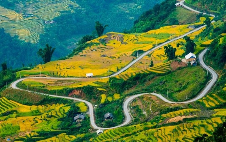
As there are more and more people traveling to Y Ty, so I would like to
rewrite a guide for you about how to get to Y Ty from Lao Cai town. As you
already know, there are 3 roads from Lao Cai to Y Ty, all start from Ban Vuoc.
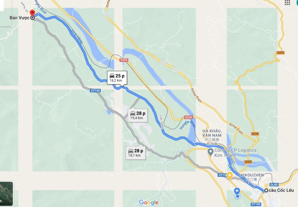
1. Road from Lao Cai city to Ban Vuoc: (Photo 2)
- The blue line is
the new road, avoiding Bat Xat town so it is pretty clear.
- The gray road goes through Bat Xat town.
Note: Both roads are speed controlled so you must be very careful.
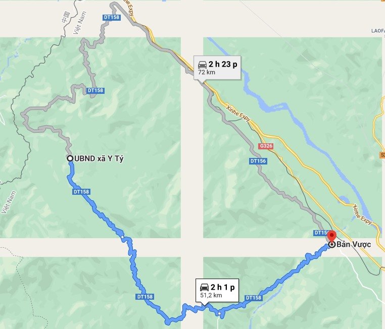
2. Road from Ban Vuoc to Y Ty:
2.1. The first road: (Photo 3)
In photo 2 is the road in blue, passing through Muong Vi, Ban Xeo, Muong Hum,
Den Sang, Y Ty. Distance 51.2 km. Currently it is the shortest and easiest road.
2.2. The second road: (Photo 3)
In photo 2 is the road in gray, passing through Trinh Tuong, A Mu Sung, A Lu,
Ngai Thau, Y Ty. Distance 72 km. This road is the longest, however, you should
take this road in order to visit Lung Po flagpole.
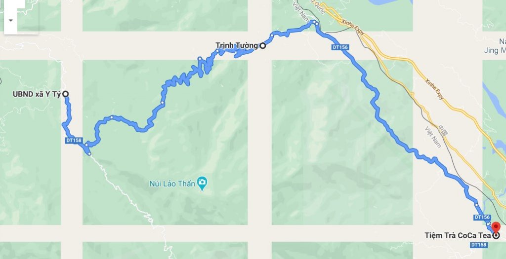
2.3. Third road: (Photo 4)
In photo 3 is the blue road, passing through Trinh Tuong, Phin Ho, Y Ty.
Distance 52.2 km. This road has been upgraded and expanded for about 3 years
now. The first part is quite flat, with few slopes, the second part has
continuous sharp curves, really nice to drive.
Note:
- Overall photo of all 3 roads for your visualization:
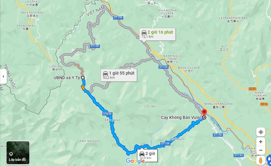
- You should take the second road to turn to visit Lung Po flagpole and the
river junction, "where the Red River flows into Vietnam".
- For the return you should take the first road to turn to visit Thac Do (Red
waterfall).
Northwest Vietnam Tours is
specialized in exploring Northwest regions such as Moc Chau, Ha Giang, Ba Be
Lake - Ban Gioc Waterfall, Mu Cang Chai with a commitment to the best quality
and service prices. |
